Words, Photos & Video: Greg Gearing
One of the most appealing things about embarking on any adventure is the time leading up to departure; I am constantly trying to envision what the trip will be like. I will gaze over a map for ages imagining what the landscape will look like and what the road, which on the map so effortlessly links two places together, will be like. I think that’s why maps intrigue me so much. It’s not that I need to know where I am at all times, but rather it gives you enough detail to allow your mind to paint a picture, but never too much detail to spoil the adventure. This is also probably the reason why I rarely end up taking a map on the trip itself.

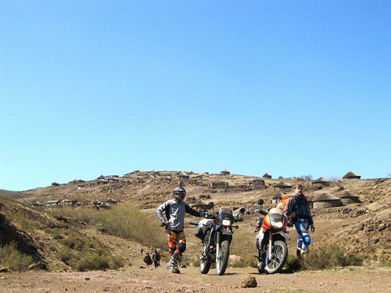
This was the case on a recent three-day trip my friend, Ryan Domleo, and I took to Lesotho, in preparation for our trans-African trip next year. For ages, I have looked at maps of Lesotho and painted pictures in my mind of remote roads and wild landscapes. I had created an adventure biking paradise, with mountain passes, river crossings, and vast tracks of wilderness. Often, my mind creates an unrealistic depiction of reality and I end up disappointed when the actual place fails to live up to my expectation. Thankfully, I can say that there was never going to be any danger of this happening with Lesotho, as it is still one of the few truly wild places in southern Africa, mainly due to the severity of the climate and starkness of its landscape.
Having left Hilton at midday, we made a beeline for the famous Sani Pass, which stands like a sentinel over the Lesotho highlands, ensuring that anyone entering the kingdom can, at the very least, conquer the labyrinth of switchbacks that make up this historic mountain road. Having made our way up the pass and through the border without too much fuss, we ventured on towards the town of Mokhotlong via Black Mountain Pass. Meandering through the rugged terrain, we rode with huge smiles on our faces, knowing that we were experiencing something few people ever get to. After a quick refuel, we went in search of St James Lodge. However, with the sun setting and no map as reference, we settled for the Senqu riverbed as a suitable site to camp for the night. Having spotted the ‘perfect’ campsite on the other side of the river, I attempted to cross the river on my fully laden bike. It did not take long for the bike to sink into the soft sand and I was knee-deep in water. Eventually, after much pulling and pushing, we got the bike free and decided there was as good a campsite this side of the river. After we finished a gourmet meal of pasta and home-cooked mince (thanks Mom), we settled in for a fairly fresh night’s sleep.
After a quick breakfast the next morning, we packed up and set off towards the district of Thaba–Tseka. We made our way along the silky smooth tar road, which wound its way through the numerous valleys that make up the Lesotho highlands. As we were cruising along, I remember thinking to myself that I hoped this wouldn’t be an entire day of tar-road riding. My hopes were soon realised as we turned off the tar road and headed south towards Thaba–Tseka, contouring our way along a fantastic gravel road. At one stage, I was so mesmerised by the views of the countless mountains and valleys that lay before us that I only narrowly avoided becoming entangled in a flock of sheep. This was a sharp reminder that when travelling by bike in Africa, you can never let your concentration lapse for too long.
The good gravel road quickly gave way to nothing more than a rocky mountain track, and it was at this time that I began to wonder if we hadn’t perhaps taken a wrong turn. Despite having no map, the exciting thought of riding along this challenging road kept us forging ahead. At times, the track would completely disappear, only to re-emerge at little villages that seemed to appear in the middle of nowhere.
Our chief source of navigation was to ask the locals along the way, and we quickly learnt there is much skill involved in getting directions from someone who speaks another language. It’s never a good idea to ask the question, “Is such and such a place this way?” because nine times out ten they will confidently agree when they actually have no idea. Rather try point in the direction you want to go and ask, “Where does this road go?” Although you not guaranteed a correct answer, your chances are much better. This, coupled with increasing your sample size and asking a few locals in the area, should give you a fairly good idea of where you are going.
We soon established that we weren’t, in fact, on our way to Thaba-Tseka, but rather en route to Katse Dam. This did not faze us too much, as that was our ultimate destination anyway. However, when we had done little more than 70 km three-hours later, we realised that this definitely wasn’t the preferred route to Katse. At a routine stop at one of the village schools to get our bearings and stretch our legs, we were relieved to find out from the Maths and Science teacher that we were only 5 km from the dam. We soon returned to that magnificent tar road and the scenery that greeted us as we wound our way down towards the dam was nothing short of breathtaking. The contrast of the dark blue water against the arid mountain landscape was spectacular.
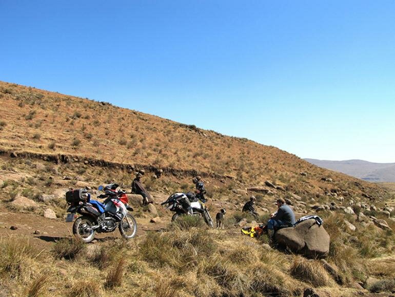
We found a spot on the river just below the hugely impressive Katse Dam wall to have some lunch and give our tried bodies some welcome rest. Ryan used the time to get some shut-eye, as the lack of sleep from the previous night was starting to catch up, while I decided to test the waters with some fishing. This was mainly to justify having lugged my fly rod all over the mountainside, more than any real attempt to catch a fish.
Having failed to supplement our supper rations in the form of a trout, we packed up and made our way to the Lesotho Highlands Development Authority Information Centre, which overlooks the Katse Dam and boasts striking views of the dam wall. The centre provides some interesting information about the Lesotho Highlands Water Scheme and visitors can also attend a short lecture to find out more. We met a few like-minded people, mainly 4x4ers from South Africa, who were also exploring this wonderful country. We quickly put our newly formed friendships to use by taking photographs of their detailed maps, to ensure we at least had some idea of where we were going from here.
We returned once more to the gravel roads, but this time with a little more direction and finally made it to the metropolis that is the town of Thaba–Tseka. After a quick refuel and coke, we continued to Sehlabthebe National Park. Stopping to ask a few locals how far we still had to go, we unsurprisingly received a number of different answers that ranged from between one to three hours, depending on the optimism of whom you asked. With daylight running out, our attention quickly switched to finding a suitable campsite for the night. Fortunately in Lesotho, a world-class campsite is never far away and it wasn’t long before we had set-up camp in a another beautiful riverbed and were enjoying a meal of three-bean couscous, all washed down with a fine-tasting Maluti beer.
The last day of our adventure seemed pretty straight forward. It was roughly 70 km to Ramatseliso’s Gate, the border situated 49 km from the Eastern Cape town of Matatiele, and then an easy-going tar road stretch back to Hilton. Home for lunch was the thought as we packed our kit and prepared for the day. But on an adventure like this, nothing can be taken for granted. This was quickly made apparent when I noticed my flat back tyre. With a little help from the magic that is Tyre Weld, it didn’t take long before we were back on the road and tackling the switchbacks of the imposing Matebeng Pass. The pass was made all the more difficult by the fact that my bike was starting to overheat, as a result of a slight fall I'd had the previous day. The only solution was to stop every now again to let the bike cool off sufficiently. We finally made it over the pass and bid the small village of Sehlabthebe goodbye.

About 10 km from the border, the real problems started. As we crested a small hill, the bike veered off to the left from what felt like a blast of wind. It turned out to be another puncture, this time my front wheel. This was of no real concern; we would just revert to our faithful Tyre Weld. However, my concern increased slightly when the sticky latex gloop started oozing out from various points on the wheel. Not all hope was lost though, as we had some patches that we could use to patch up the tube. But then we realised we had the wrong wheel spanner and there was no way we could get the wheel off the bike. All we could do was proceed slowly to the border and hope someone there could help us out.
Hope was fully restored when we were able to borrow a wheel spanner from the local Chinese shop. We spent the next three hours trying to fix the puncture, taking the tyre off and putting it back on the rim no less than three times, and in the process burning out our small bicycle pump. Eventually, after borrowing a compressor from an insurance salesman at the border (this guy must be commended for his tenacity and driving to the middle of nowhere on a public holiday to sell insurance to border officials), we were able to get on our way, all be it for a short 5 km when the tyre went flat, again.
Taking into account the time and fact that we had no way of fixing the tyre, we decided to continue riding with the flat tyre and try make it to Underberg, some 120 km away. We would leave the bike with my bother-in-law and continue home two up on Ryan’s bike. Providence came when we bumped into a family of 4x4ers we’d met at the border. They were eager to help us and very kindly offered to take us to friends of theirs, who lived on a farm nearby, and whose sons were avid motorbike riders. I have always known that the generosity of the honest, hard-working farmers was abundant and once again this was proved when Gaye Kirk and her family put a halt to their afternoon activities and literally bent over backwards to help repair the bike. Had it not been for these kind folk, we might still have been out there trying to nurse the bike home.
As darkness fell and a thick mist closed in on us, I couldn’t help but think what an adventure we’d had. The past three days had felt like a month, with so much packed into each day. Lesotho truly is an adventure-riding paradise and no matter how easily the roads seem to link on the map, you will never be disappointed if you decide to enter the Kingdom of Lesotho.
