Words: Francois Flamengo | Photos: Rudi & Mari-Leana Jacobs & DO IT NOW Media
In my last two articles (Click here to read) on Authentic Africa, I described the craziness Elri, Rudi, Mari, and I went through travelling by car from Johannesburg, through Zimbabwe, and finally into Malawi where we spent four incredible days on Mumbo Island. Our brief time on this adventure island was incredible, but the time had come to bid farewell to the island and Africa Kayak’s friendly crew and head for home. The final part of our journey was about to start.
Just as we knew the trip to Malawi would be filled with challenges, we were under no illusions that the return trip would be any different. The one main difference, however, was that we were not racing against time anymore. Disembarking the boat at Kayak Africa, we topped up with fuel as we got back to the tar road and at just R22 a litre, it was a bargain ;-)
Our first stop was Ugezi Tiger Fishing Lodge at Cahora Bassa, It was only 500 km away, but it took most of the day to get there because we had to drive back on the same pothole-littered road from the border to Tete. The name Cahora Bassa came about as a result of an earlier misspelling of the name - it was previously spelt Cabora Bassa, which means ‘where work stops’ or ‘the work is over’. Situated in the Tete Province, in Mozambique, it is Africa's fourth largest artificial lake, and in Africa, only Lake Volta (in Ghana), Lake Kariba (on the Zambezi River system), and Lake Nasser (in Egypt) are bigger in terms of surface water.
We reached Ugezi Tiger Fishing Lodge late on Thursday night. The lodge is nestled amongst beautiful baobab trees and on the picturesque slopes of the mountains, forming the gorge area of Lake Cahora Bassa. With unlimited fishing for various species, especially tiger fish, bream, vundu, chessa and Cornish Jack, the lodge is popular amongst avid fishermen. There are camping facilities and chalets, as well as a restaurant that offers a variety of great meals, well worth a stop if you are in the area.
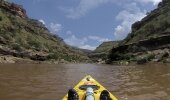
After scouting the area on the Friday and recovering from the drive back from Malawi, we booked a fishing trip for the Saturday. The trip included a boat, fishing tackle, and a skipper to take you to the best spots to try your luck. As we chugged along to our spot,we were surrounded by towering cliffs and mountains, which hugged us from both sides. We passed hippo, saw a crocodile, and waved at some friendly locals staying on the banks in their traditional huts. From a fishing perspective, it was not our day and although the weather was magnificent, we only had one strike, which we weren’t able to land. We were told that the best time to visit the lodge is in summer, over December, as the tigers are more active in the warmer water. On our way back, we stopped at the dam wall for a few photos and were once again surprised by the size of this magnificent man-made stucture in the ‘middle of nowhere’. We will be back one day, preferably in fishing season, to explore the rest of this beautiful place.
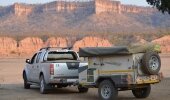
After our final dinner on Saturday night, we went to bed early so that we would be well rested for the drive back - however long that road might be. Our plan was to reach one of the two reserves, Zinave National Park and Banhine National Park, which we had found on the Garmin. This would get us close to the Pafuri Gate, where we planned on crossing the border into South Africa. If Lady Luck was on our side, we would stay an extra evening in the Kruger Park and enjoy a game drive or two before hitting the road back home. With thoughts of finding the ‘Big Five’, we left the lodge early on Sunday morning and reached Chimoio in less than four hours. Without any trucks on the road, the drive was great and we were confident that we'd find accommodation at one of the nature reserves along the way, and still reach Pafuri before dusk.
The road south on the EN1 was very good and although we had to slow down when driving through the many small towns, we made good time. We filled up at a small petrol station in Nova Golega before taking the road less travelled on the 427. We chose this road because we'd been warned that there were some problems with rebels in the Inhassoro area and visitors had to be escorted by police to ensure their safety. That was more action and adventure than what we were looking for.
On the map, the 427 (a gravel road) looked ‘okay-ish’. It turned out to be a bit washed away, with a few surprise bumps at the small water bridges, but all was going well. Then the unexpected happened. I heard a noise coming from underneath the car, so I immediately stopped. When I got out to inspect what the problem was, I found that the top nylon washer on the rear right suspension, which holds the shock in place, had come off. The timing was terrible because we needed shocks to cover the rest of the gravel road, so they needed to be in perfect working order. We were exactly in the middle of this route and the closest petrol station (and hopefully some kind of mechanic) was all the way back from where we had come from. Rudi and I both searched the road to see if we could find the washer, but all we managed to find was the rubber that separated the shock from the chassis. Luckily for us, there was a washer on Rudi’s roof rack, which we used to temporarily sort out our problem. An hour later, after some interesting bush mechanics, assistance from the mechanic of a passing cotton delivery truck, and letting down the tyres to 1.5 bars to take some of the pressure off the shock, we set off once more. Deflating the tyres helped, but we were still wary about going as fast as we had been, so we stopped every 10 km to check if the washer was still in place.
By 15h00 that afternoon, we reached a small village in the middle of nowhere. Stopping to chat to the local police officers about which route was best, they told us that the best bridge to cross the Save River, was to the east of the Zinave National Park. Even though it had been partly washed away by the floods, they said our vehicles ‘should’ be able to cross the river to the west, where we were headed. It was like being stuck between a rock and a hard place, as turning back meant we'd lose four hours. Rudi and I were both trained in wading and had recovery equipment with us, so we decided to try our luck with the river crossing. My biggest concern was that if the bank of the river was too high, it could be tricky getting out. And if we didn’t get there before the sun went down, we would have to cross the river at night, which was not ideal.
So on we went on a sandy jeep track, which got smaller and smaller until eventually it was only a small little winding track in the riverbed. By this time, the sun was sinking below the horizon and although a beautiful sight, we were now faced with having to cross the river in the dark. Eventually we reached a section where the bridge was out at Massangena. Like any African problem, there is always someone who sees a potential money-making scheme and the locals once again came to the rescue. For a R100 fee, they would guide us through the river and show us the line our vehicles should take. Even though the water didn’t seem that deep, we agreed that this would be the safer option and save us some time, so we paid the fee. Thankfully, the riverbed was sandy and gave us good grip to get out and onto the riverbank.
Our challenge now was that it was almost 19h00 and the reserve on the map was nowhere to be found. It was dark, we had nowhere to stay and no idea where we could stop safely either. We were starting to get rather anxious. The next town (rural settlement) was Machaila, a 100km away. En route, Elri started frantically searching for accommodation options on all the GPSs and found exactly one, a small overnight camp registered on the Garmin, about 40 km past Machaila. The Machaila Community Campsite was described as a chief camp with running water and basic ablution facilities. At around 22h00, we finally found the camp - and our relief was profound. There was another vehicle and a tent already pitched, obviously better prepared than us. We had some coffee, finished off the bread rolls, and wound down around a small fire that two ladies from this community village had made for us when we arrived. Travel weary, we got our sleeping bags out for another night in Chalet ‘Hi-Lux’ and ‘FJ’ ;-) In no time, we were fast asleep.
By the time we woke up the next morning, our neighbours were gone. Alone in the camp, we had some coffee and rusks, packed up the ‘camping kettle’, and were on our way to Pafuri via Mapai (136 km). Although our stay at the camp was short, it had been our saving grace in the middle of nowhere and we were privileged to have met this amazing community of people who were willing to let us into their 'village' for a safe night, fresh water, and a warm fire.
Our original plans to pass through Pafuri Gate changed, as the bridge had been washed away a few months back as a result of the floods. This rerouted us another few hundred kilometres, as we now had to drive all the way south to enter the Limpopo National Park at Massingir Dam. We googled a place to stay at in the park and found chalets just inside the Massingir Gate. We went to Motel Manganhe, which was outside the park, and enjoyed a local dinner, all washed down with some Manica (local beers) and cokes. When we finally got to our chalets, we were pleasantly surprised with our accommodation and enjoyed a good night’s rest.
When we reached the tar road at Phalaborwa the next morning, and were back on home turf, it was as if Christmas had come early. It’s amazing how you learn to appreciate the small things in life, like a decent tar road and a shop with countless options to choose from while your car is filled up for you - and all your bank cards work!
The drive to Malawi had been our initial adventure, but in the end it was the road there and back that was a much bigger adventure and will probably stay in our memories for years to come because nothing could be planned to prepare us for it. Would I do it again? In a heartbeat, but next time I will not underestimate doing research on Plan B and C before I go because in Africa, where the name of the game is, expect the unexpected!
Don't miss my FINAL article where I will cover travel tips and a review on all the equipment we found useful on the trip.
Cahora Bassa:
This big dam in the Zambezi River generates enough electricity to power the entire southern part of Africa. The dam is 171 m (560 ft) high by 303 m (994 ft) wide at the crest. The system was built between 1977 and 1979 and can transmit 1920 megawatts at a voltage level of ±533 kilovolts and 1,800 Amperes. The 1,420 km (880 mi) long power line runs through inaccessible terrain, so it is mostly built as monopolar lines, 1 km (0.62mi) apart. In the event of a single line failure, transmission with reduced power is possible via the surviving pole and returned through the earth. http://en.wikipedia.org/wiki/Cabora-Bassa
Machaila Community Camp:
S22 15.696 E32 57.163 - This is a project by Mozaic Upliftment Trust and for more information contact Gerhard Erasmus on
Distances as seen on the Machaila Camp board - note the distance and driving time:
Vilankulo 334 km - approximately 9 hours diving
Mapai 136 km - approximately 3 hours driving
Pafuri 225 km - approximately 6 hours driving


